Moving Barbed Wire: Geographies of Border Crossing during World War II
Abstract
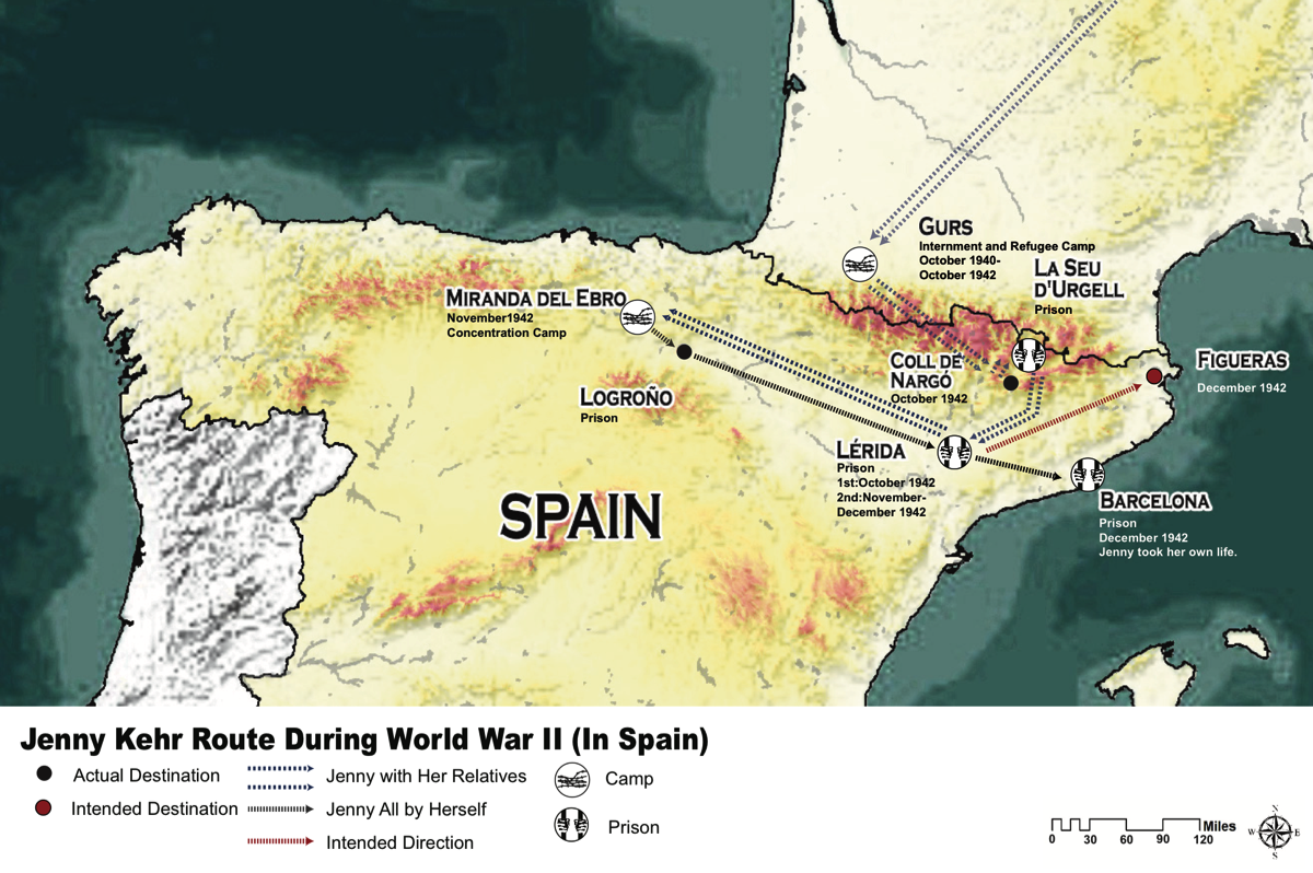
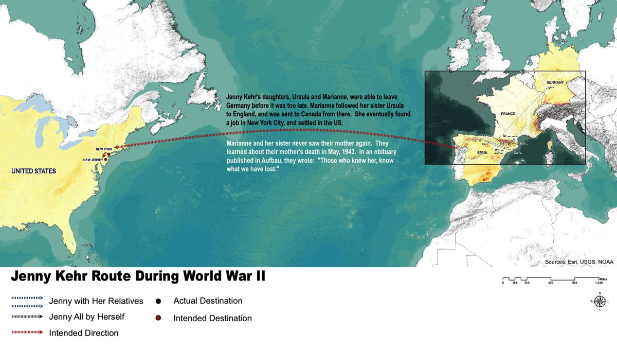
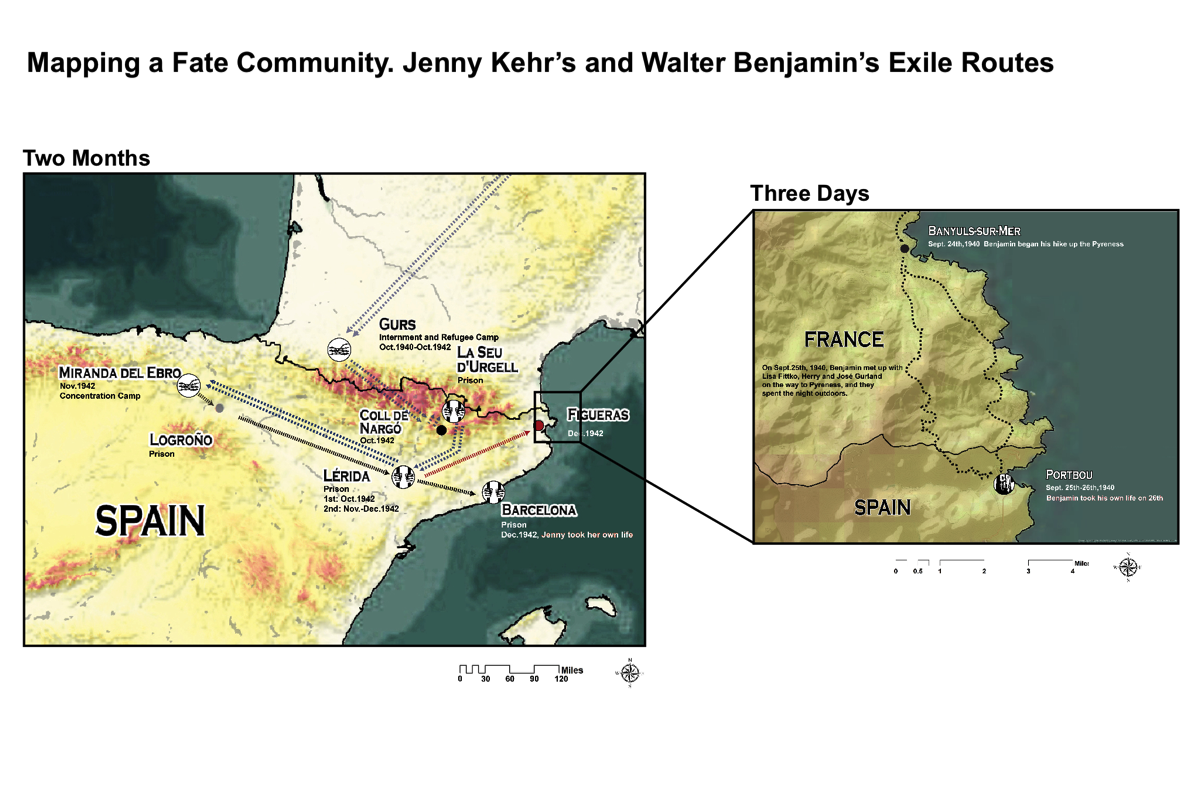
In their attempt to flee from fascism Jenny Kehr and Walter Benjamin, crossed the border between Spain and France clandestinely. A close study of Benjamin’s and Kehr’s route paths, in the broader context of a study of migration, identity, and space, leads to three separate, yet related questions:
1) what do we learn about borders and border crossing by studying specific experiences of refugees during World War II;
2) how do route paths of exiles through Spain fit with the memory of World War II in different national contexts; and
3) how did individuals experience the actual locations that they crossed.
Mapping the exile routes of World War II, specifically, routes that led refugees through the Pyrenees, makes it possible to tackle these questions, and to explore the relationships between them.
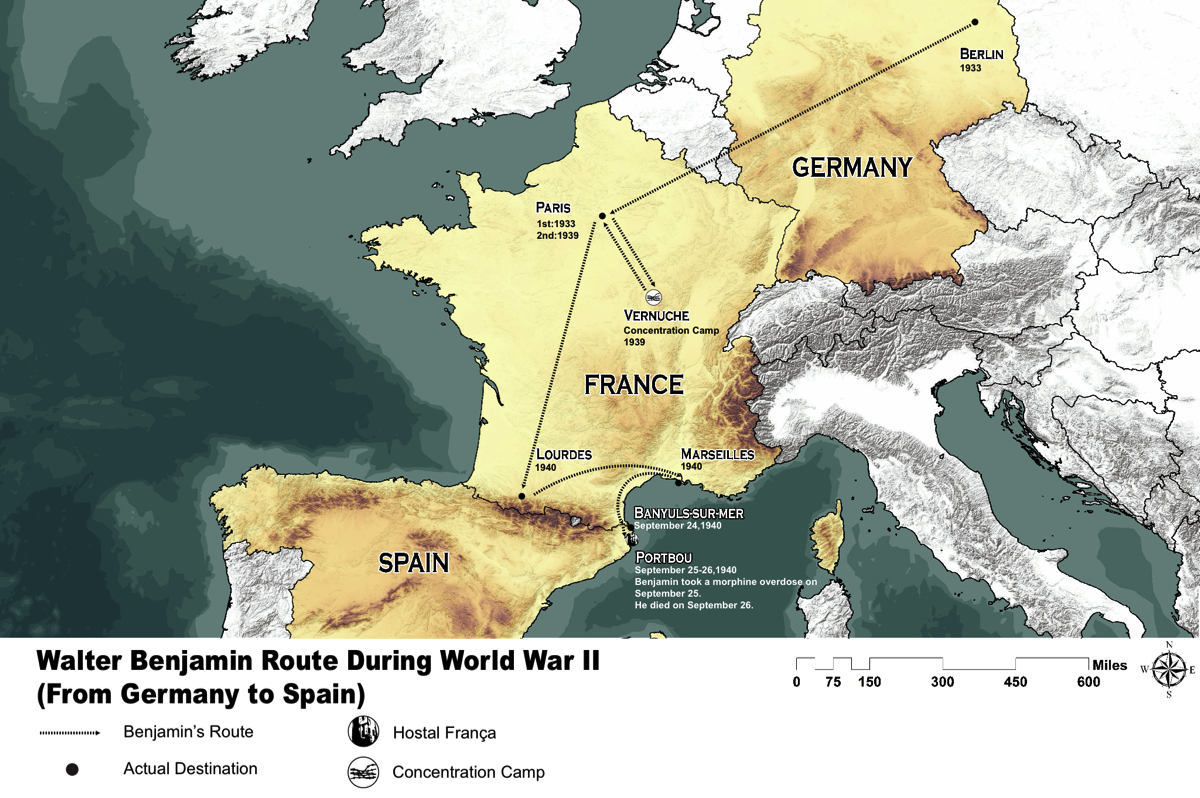
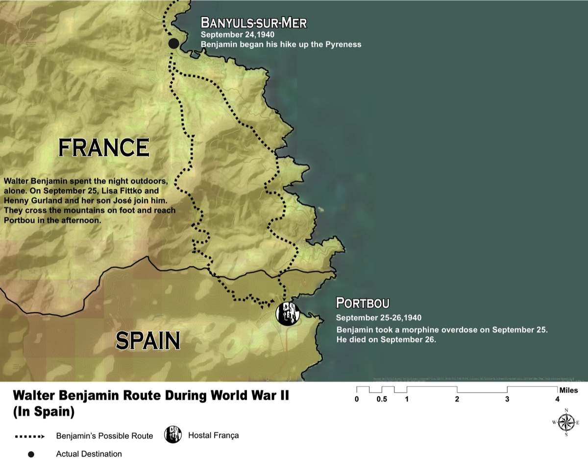
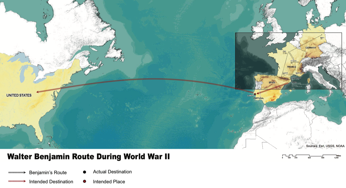
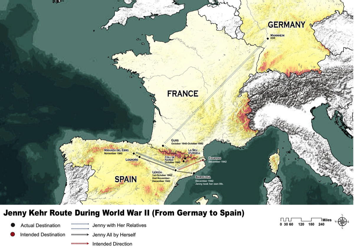
All maps designed by Ophelia Li, Washington University in St. Louis
ArcMap
Adobe Suite (Illustrator, Photoshop, Indesign)
• ESRI world terrain base map
• Elevation, administration areas data for Germany, France, Spain and Portugal in http://www.diva-gis.org/Data
Josep Calvet, Las montañas de la libertad: el paso de evadidos por los Pirineos durante la Segunda Guerra Mundial, 1939-1944. (Madrid: Alianza Editorial, 2010)
Manuel Cussó-Ferrer, “Walter Benjamin’s Last Frontier. Sequences of an Approach,” in For Walter Benjamin, eds. Siegfried Unseld et al, translated by Timothy Neville, (Bonn: AsKI, 1993):154-161
Lisa Fittko, Escape through the Pyrenees. (Evanston, Ill: Northwestern University Press, 1991)
Rosa Sala Rose, La penúltima frontera: fugitivos del nazismo en España. (Barcelona: Papel de liar, 2011):
Patrik von zur Mühlen, Fluchtweg Spanien-Portugal: die deutsche Emigration und der Exodus aus Europa 1933-1945. (Bonn: J.H.W. Dietz, 1992).
© Tabea Alexa Linhard 2017